

Locations on holiday and day trips
Sunday 17 August 2025, 17:34 by Nando Harmsen | 2,220 views | 5 commentsThis article was translated from Dutch with the help of AI. Read the original.
Do you still know where you went during your holiday? Or perhaps on day trips? Is it always a puzzle to work it out? Always photograph an information sign on location to make things easier.
It is always useful to know where you took your photos. Especially on holiday or during day trips. You can write it all down, but who still carries a pen and paper these days?
What we do carry with us is a smartphone. It has GPS built in for navigation. If you use that, you can of course take a photo with your smartphone on location. That photo contains the GPS location data.
The condition is that you also have GPS enabled for your photos. An alternative is a GPS tracker that you synchronise with the time on your camera. Or you can use the GPS options built into your camera.

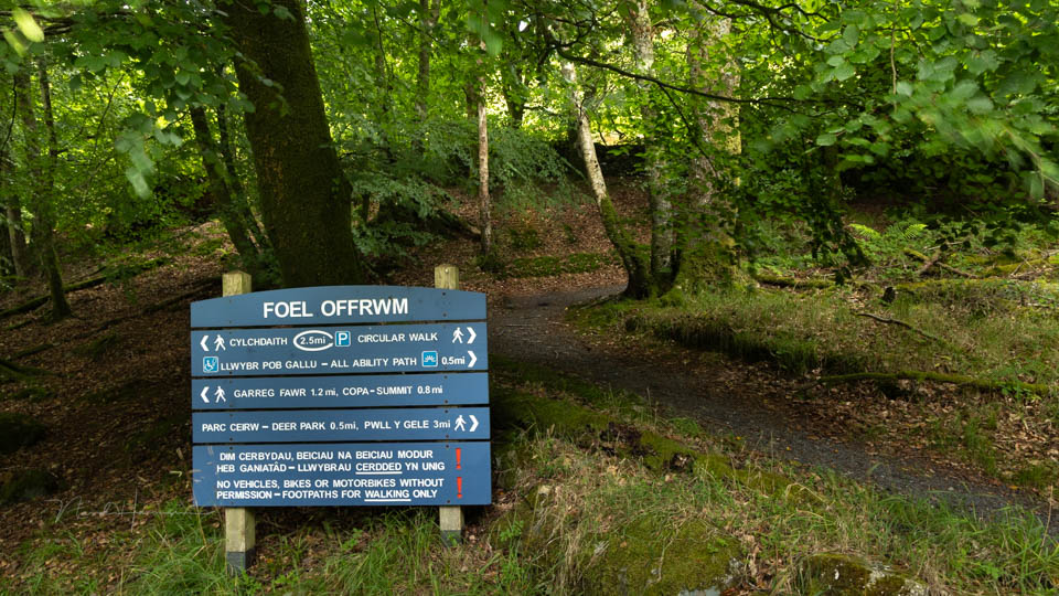
You can also make it a habit to photograph information signs at the location. They provide not only the correct name, but also extra information about the location. This can be very useful, especially on long-distance trips and holidays.
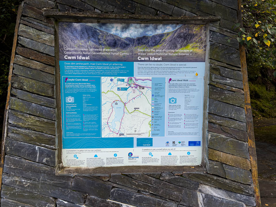
Photograph such a sign before you set off at the location. Then you know where the photos from that location begin. You can easily copy that information into your metadata or keywords. Or you can write it down for your photo book.
There is another advantage to this method. Is there a map on the information sign? Then you often have the route information as well. Very handy.
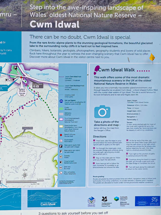
Unfortunately, I still sometimes forget to take a photo of such a sign. But I do try to remember. Fortunately, I can often find the locations again because I researched them beforehand.
How do you find the location of your photos again? Or is it not that important to you? Let us know in a comment below this post.
About the author
Nando Harmsen has been photographing for more than 40 years. He specialises in wedding photography and landscape photography. Nando also gives talks, workshops, masterclasses and photo trips, and regularly reviews new and interesting equipment.
You might also like
-
 An Ode to Holiday Snapshots
by Michiel Heijmans
-
 5 tips to turn your holiday photos into great travel photos
by Nando Harmsen
-
 5 tips for taking your camera on holiday with peace of mind
by Nando Harmsen
-
 Holiday Photos with Tourists in the Frame
by Nando Harmsen
-
 How do you deal with photos on a photography trip
by Nando Harmsen
-
 I'm Going on a Trip and I'm Taking
by Nando Harmsen
5 comments
-
 Chiel wrote on Monday 18 August 2025 at 06:52 | reply
One step further is to use an app on your phone to record your route (Strava, Komoot, virtually any hiking or cycling app) in combination with Lightroom to manage your photos. In Lightroom, you can use the recorded GPS track to add GPS coordinates to every photo you have taken and display them on a map. You can then always see where a specific photo was taken.
Translated from Dutch. -

 Nando
wrote on Tuesday 19 August 2025 at 09:56
| reply
Nando
wrote on Tuesday 19 August 2025 at 09:56
| reply
I already mentioned that in my message: a GPS tracker on your smartphone.
Translated from Dutch.
I like GPS coordinates, but you miss the information you can find on a sign at a location. You can look it up again, but with a photo you have it right at hand. You just look at the photo -
 Nico van Amstel wrote on Tuesday 19 August 2025 at 13:26 | reply
I always do that too in museums or zoos, for example - a photo of a statue or an animal followed immediately by a photo of an information sign.
Translated from Dutch. -
 MacBigfoot wrote on Tuesday 19 August 2025 at 14:12
| reply
MacBigfoot wrote on Tuesday 19 August 2025 at 14:12
| reply
I don't think it's that important, so I very often forget to turn on the GPS tracker on my phone.
Translated from Dutch.
If I do end up finding it useful afterwards to give the photos a location in LrC, I usually know (roughly) where they were taken. In the end, I only do it for myself anyway.
Taking a photo of the information board is indeed something I’ll be doing more often, can be done with both your phone and the camera for an overview in your library.
Although most landscapes in NL also have a lot of information available online. -
 guest wrote on Tuesday 19 August 2025 at 19:43 | reply
I already indicated that the tracker/Lightroom combination was an extra. It’s quite funny to be able to see the route you walked/cycled or drove on the map in Lightroom and vice versa: quickly find photos you took at a certain location.
Translated from Dutch.
Have your say
Please note: Articles older than a week can only be commented on by signed-in visitors.Would you still like to comment? sign in or create a free account.
Become a better photographer every week
A practical photography tip in your inbox every week.
39,079 photography enthusiasts already receive the tips! More about the weekly mail. Or keep up to date via  Facebook.

Elja Trum
Photofacts; everything to do with photography!
Would you like to take better photos and keep up with what is happening in photography? Photofacts publishes articles that teach you something about photography — from a product announcement to a practical shooting tip or a look at a website. Photofacts covers photography every day and is a hobby project of Elja Trum's that got out of hand. The articles are written by a team of volunteer authors. If you would enjoy writing one or more articles for Photofacts, do get in touch.More about PhotofactsPhotofacts is made possible in part by
