

The Columbus P10 GPS Logger for Your Photo Trips
Friday 24 February 2023, 15:30 by Nando Harmsen | 5,873 views | 7 commentsThis article was translated from Dutch with the help of AI. Read the original.
You can link GPS coordinates to the Exif data of your photos. This means you always know where you were standing when you took a photo. There are several ways to do this, including a separate GPS data logger. I tried out the Columbus P10 GPS data logger.
The options at a glance
Some cameras have built-in GPS, but this uses extra power, so the battery runs down faster. In addition, you are not always guaranteed an accurate location or a connection to satellites.
You can connect the camera to your camera brand's smartphone software. You then use your smartphone's GPS for the location. This works too, but as far as I know it requires a continuous connection between the camera and smartphone.
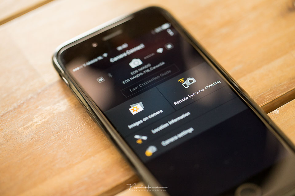
You can download a GPS tracker app for your smartphone and record the route you take. You can then use the GPS data log later to link the location to your photo.
This works very well, as long as the time on your smartphone and camera is exactly the same. But you do have to make sure your smartphone stays sufficiently charged.
If you do not want to depend on the GPS of your camera or smartphone, a separate GPS data logger is a solution. The Columbus P10 is such a data logger. It keeps an exact record of where you have been.
You can read out the data log and import it into Lightroom Classic, for example. I took a closer look at this data logger.
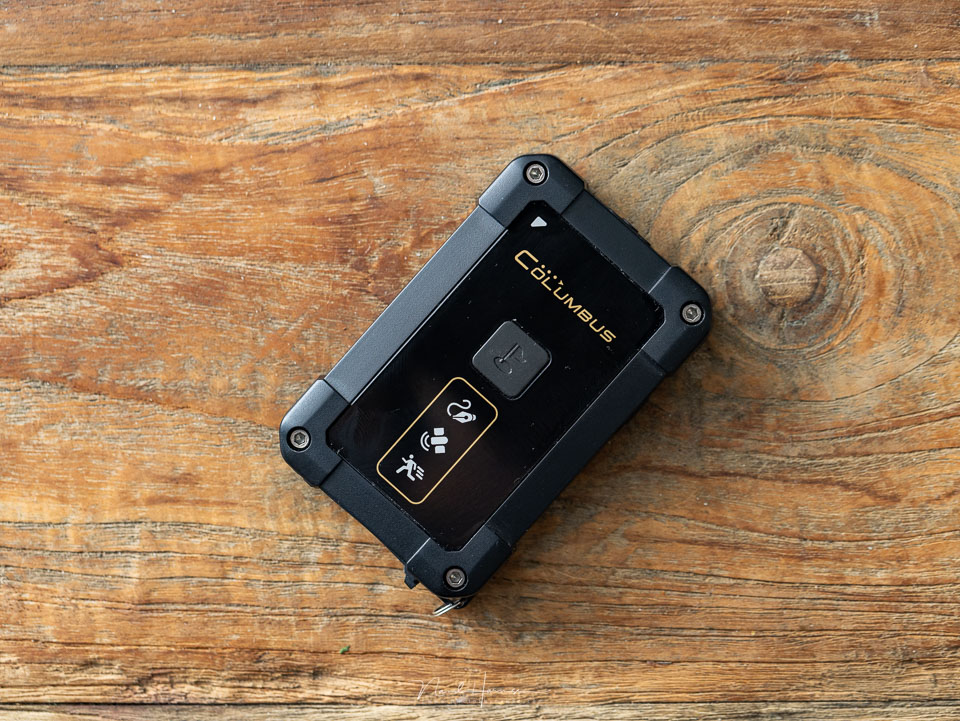
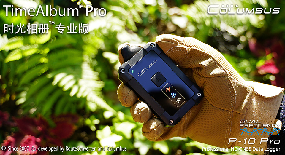
Columbus P10 professional data logger
What does a data logger need to do? Nothing more than store the GPS coordinates at set intervals. This produces a list of GPS points showing the route you walked, cycled or drove.
A GPS data logger also needs to last a long time on a single charge, so you do not have to worry about the data logger stopping halfway through.
All the extra features, such as an LCD or OLED screen, lights, LEDs and other power consumers, are unnecessary. In principle, you put the GPS data logger in your bag and do not need to think about it again. Oh yes, the device also needs to be small, compact and lightweight.
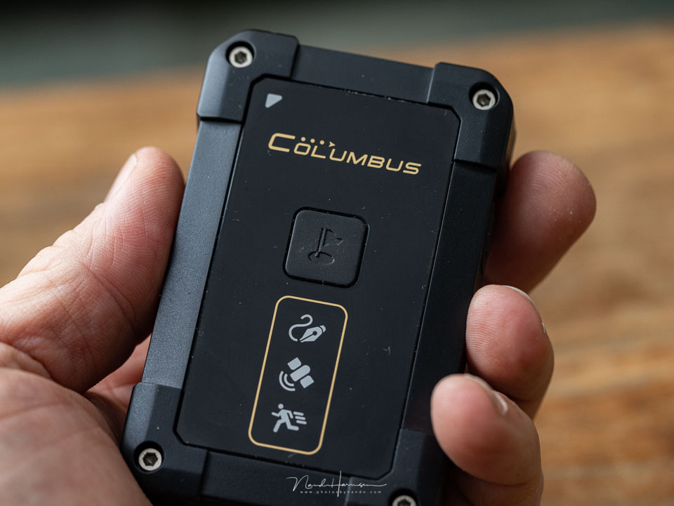
The Columbus P10 comes quite close to meeting these requirements. Apart from the LEDs it has. But of course, you do want to be able to see whether the device is switched on and doing its job. So a few LEDs are useful.
Its dimensions are 8.5 x 5.5 x 1.7 centimetres. It weighs 82 grams. Battery life is approximately 50 hours at 1 Hz, which means that one data point is stored per second. This is enough for two full days of 24 hours.
If you use the P10 for about 8 hours a day, you can get almost a week from one charge. Perfect.
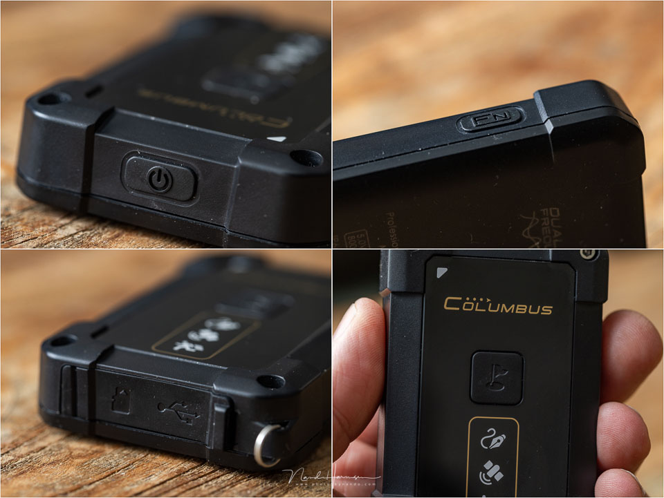
The P10 is a dual-band receiver that guarantees an accuracy of between 0.5 and 1.5 metres horizontally, and 1.5 metres vertically. It has a weather-resistant housing, provided that the rubber seals around the connections are properly closed.
There are not many buttons. There is an on/off switch, an adjustable function button on the side and a button for recording a Point of Interest.
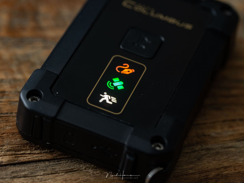
The LEDs on the front are bright enough to read during the day as well. Their brightness cannot be adjusted, which makes the P10 rather noticeable in the dark.
The top LED flashes every time a point is logged, the second LED indicates GPS reception. The third LED flashes when the unit detects movement.
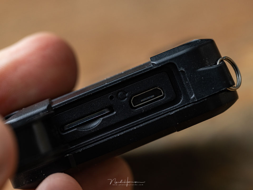
The micro-SD card slot is found behind the rubber flap on the underside. The unit accepts cards of up to 32 GB. Inserting the card is a little awkward, but in principle you never need to remove it.
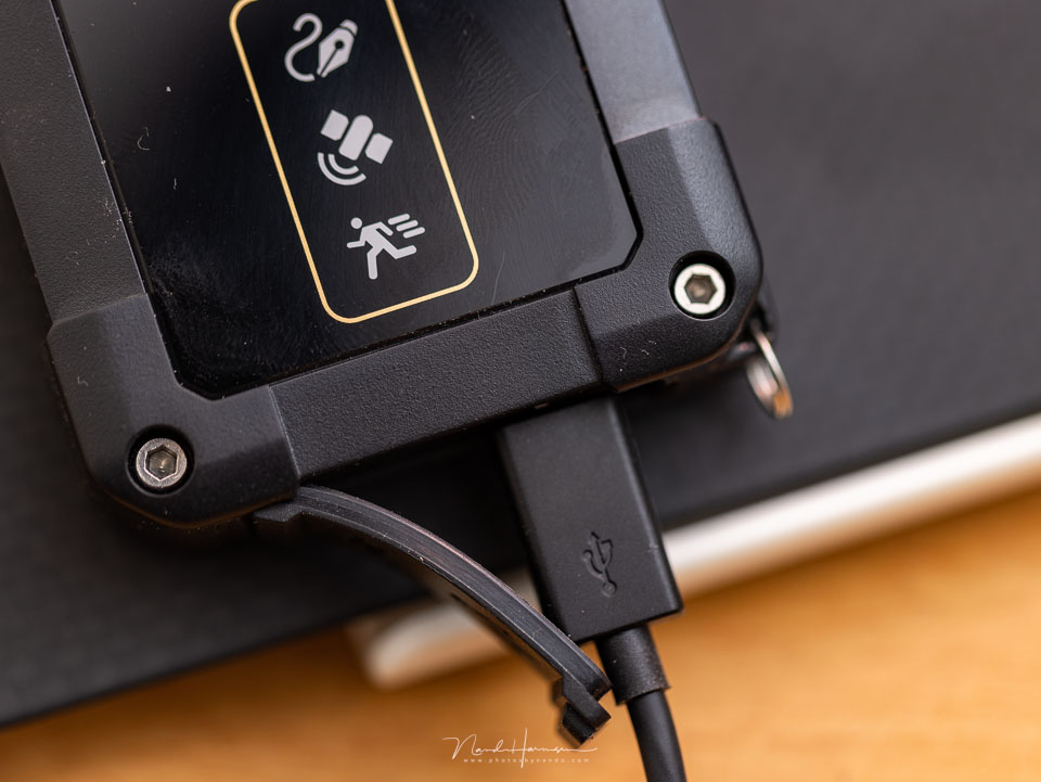
When the unit is connected to the computer via micro-USB, you can read the micro-SD card. The P10 will be charged at the same time. If configured this way, each track is saved as a CSV file. You can open this with a spreadsheet programme such as Excel.

Configuring
Setting up the Columbus P10 can be a little challenging. You need to download a config.txt file and load it. By default, the unit is set to UTC time, but you can adjust this for your time zone. For the Benelux, it should be set to +1 hour.
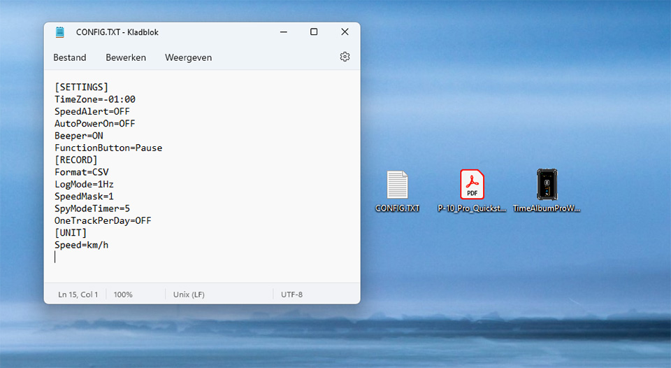
The settings cannot be adjusted easily. You need a computer and must be able to edit the config.txt file.
This is a major disadvantage of the P10 for logging data during your photo trip. Especially if you cross time zones. Or you have to keep your camera set to the same time as your P10.
Synchronising the time on the camera and the P10 is difficult anyway. You need to know the UTC time or the time zone you have set. You can usually use the time on your smartphone, but you do need to be certain that it is exactly correct. You depend on your provider for this.
Timealbum Pro
You can read the CSV file created by the P10 in a spreadsheet programme. You can even adjust data, such as a timestamp, if you want to. Some knowledge of a spreadsheet programme is required for this.
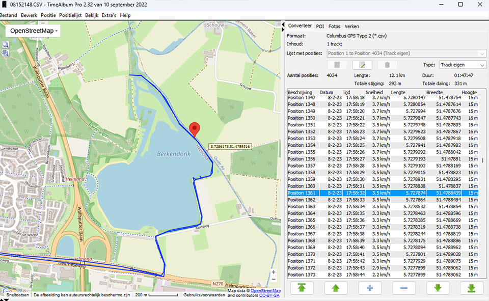
You can read the track with the free Timealbum Pro software. It shows the route on a map where you can click on each point, so it is highlighted on the map.
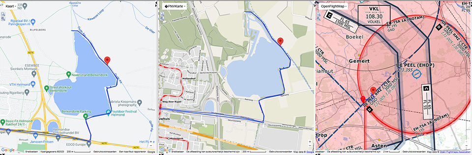
You can select a large number of maps. This can be the standard Google map or OpenStreetMap. The list of possible maps is long, but not every map will be useful.
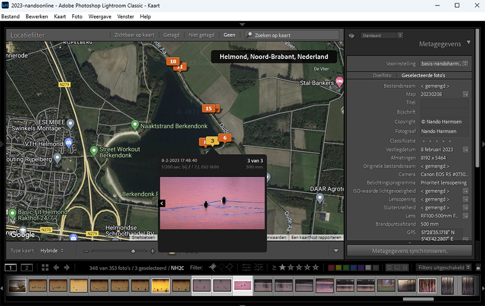
You have to use the Timalbum Pro programme to export your track to, for example, a GPX file. These are the files you can use to import it into Google Maps or a programme such as Lightroom Classic.
Conclusion
The Columbus P10 is a handy tracker that you carry with you and do not need to think about for the rest of the day. It does what it needs to do and is as accurate as promised. The free Timealbum Pro makes it easy to read and export the tracks for various purposes.
It is excellent for keeping track of your routes. If you use it to add GPS coordinates to your photos, there are some hurdles. The configuration, synchronising the time with your camera and the problem of crossing time zones can be difficult. It is important to know what you are doing.
The Columbus P10 is a good tracker that could certainly be improved. Think of a visible clock, easier time zone settings and dimmable LED lighting. But I think I am looking at it more from a photographer's perspective, while the P10 was not specifically made for that purpose.
Besides being a normal tracker, the P10 can also be used as a spy tracker, with extended battery life by increasing the interval between recorded points. You can then track the P10 remotely for up to 24 days. This could be useful, for example, for tracking your luggage when flying.
The Columbus P10 is reasonably difficult to obtain. You have to search for it a little. The price is around 250 euros. A simpler version is also available, the Columbus P1 mark II, which will cost around 150 euros.
Strengths and advantages
- Accurate
- Easy to use
- Long battery life
- Use does not rely on the camera or smartphone
- Easy to record waypoints
- No unnecessary features
- Weather-resistant
- Timealbum Pro requires no installation
- Only logs points when moving
Weaknesses and disadvantages
- No large opening for a carabiner
- No belt clip
- LEDs cannot be dimmed
- Settings are difficult to adjust
- No good battery indicator
- Synchronising the time with the camera is difficult
- Charging time of 3.5 hours is a little long
- Rubber cover for the connection
- Still has an old-fashioned micro-USB connection
- Timealbum Pro lacks the option to adjust the timestamp
- No visible time display for synchronising with a camera
The Columbus P10 is perfectly suitable for creating GPS tracks. But unfortunately, it does not provide a ready-made solution for easily linking GPS data to your photos. You need to be interested in it and willing to change the necessary settings when required.
If you have that interest and enjoy saving all your trips and walks as a track, possibly together with the location of your photos, the Columbus P10 could be suitable for you. Or the Columbus P1 mark II if the P10 is too expensive for you.
About the author
Nando Harmsen has been photographing for more than 40 years. He specialises in wedding photography and landscape photography. Nando also gives talks, workshops, masterclasses and photo trips, and regularly reviews new and interesting equipment.
You might also like
-
 Locations on holiday and day trips
by Nando Harmsen
-
 Review: Blurb photo books via Lightroom Classic
by Nando Harmsen
-
 What's new in the Lightroom Classic 13 update?
by Nando Harmsen
-
 What is the Comments tab in Lightroom Classic for?
by Nando Harmsen
-
 Presets in Lightroom Classic
by Nando Harmsen
-
 What are Lightroom plug-ins and what can you do with them?
by Dick Holtman
7 comments
-
 Frans van Schaik wrote on Tuesday 28 February 2023 at 14:32 | reply
A data logger is indeed a handy device. By linking the GPS data to your photo files, you always know exactly where the photos in question were taken. I have been using the BT-Q1000XT from QStarz myself for years, to my complete satisfaction. For around 100 euros, you can already buy this data logger, which according to the manufacturer has enough memory to record geolocations for up to 40 days. Charging is of course needed more often. With the included software, you only have one map (Google) at your disposal. Exporting to multiple track files (including GPX) is very easy.
Translated from Dutch. -

 ifiamminghi wrote on Tuesday 7 March 2023 at 12:40
| reply
ifiamminghi wrote on Tuesday 7 March 2023 at 12:40
| reply
I initially use the (renewed) Canon app, which really does work very well, but of course you have to establish the connection every time, and sometimes you take a photo faster than the connection is established... But that's a matter of being a little alert.
Translated from Dutch.
In addition, I use a (Garmin) hiking GPS, which also saves the route, and I can also import that route into LR if necessary. The advantage of the hiking GPS is, among other things, that I have a topographical map with me everywhere, and should I lose my way, I can easily find a way back.
Moreover, I also get some data such as the distance walked, the time, speed (usually more like slowness, one tends to stop quite a lot to take photos),... -
 SK22 wrote on Wednesday 28 June 2023 at 20:39
| reply
SK22 wrote on Wednesday 28 June 2023 at 20:39
| reply
Hi Nando, thanks for the review. What have your experiences been with this logger in the city/built-up areas? Do you happen to have a log you’d like to share, I’m wondering whether to buy this logger.
Translated from Dutch. -

-
SK22 wrote on Thursday 29 June 2023 at 18:57
| reply
Thanks Nando! A log file in a city would be nice, I'm curious to see whether the dual channel works well. Maybe you could include that file in this review, more people would benefit from it.
Translated from Dutch. -
SK22 wrote on Friday 25 August 2023 at 14:10
| reply
Hi Nano, I was wondering if you happen to have a log you want to share yet?
Translated from Dutch. -
Nando
wrote on Monday 28 August 2023 at 15:05
| reply
Hello SK22
Translated from Dutch.
I do have a file for you, but I don't have one that was logged in the city. It's all mountains, villages, and that sort of thing.
I can't attach one to this message for you to download, but I can send you a file. Send me a message at nando @ photofacts. nl and I'll make sure you get one sent to you.
Have your say
Please note: Articles older than a week can only be commented on by signed-in visitors.Would you still like to comment? sign in or create a free account.
Become a better photographer every week
A practical photography tip in your inbox every week.
39,077 photography enthusiasts already receive the tips! More about the weekly mail. Or keep up to date via  Facebook.

Elja Trum
Photofacts; everything to do with photography!
Would you like to take better photos and keep up with what is happening in photography? Photofacts publishes articles that teach you something about photography — from a product announcement to a practical shooting tip or a look at a website. Photofacts covers photography every day and is a hobby project of Elja Trum's that got out of hand. The articles are written by a team of volunteer authors. If you would enjoy writing one or more articles for Photofacts, do get in touch.More about PhotofactsPhotofacts is made possible in part by
